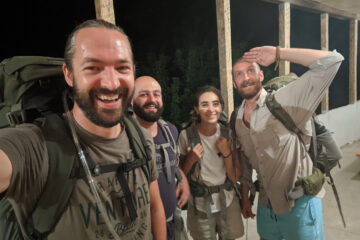
On day 3 we left the village of Kapuyt aiming for Artavan, the main village on the next valley to the north. To reach the blazed trails that would get us across the mountains, we chose an alternative way to exit Kapuyt: on the map there was a path circling around the farms at the edge of the village, which seemed nicer and was also passing through some interesting khachkars (cross-stone) carved into a cliff, so we asked Tsovinar to take us that way.

As we headed further up the mountains I thought this path must have been similar to the one Ashot, a local farmer I met here 4 years ago, had shown me to get up towards that same pass we were going for today. But I couldn’t quite recognise it, until we reached further up and, looking down over a ridge, I finally saw what must have been the way Ashot took me last time.
The one we were walking on now was a much nicer option, and that sparkled the first interesting realisation of the day: if you ask a local for a path to go somewhere, they’ll show you the most straight forward connection. And it makes sense, these people work in the mountains, they need to be efficient above anything else. Unfortunately this doesn’t always match well with the work of trail designers like Tom Allen, who instead is looking for gentler gradients, and better views, to give hikers a good experience. It was interesting to notice how the practicalities of the different uses of mountain paths could affect the way you look for routes across the same landscape.

On top of the pass, we begun following a very nice brand new trail built by HIKEArmenia and Trails For Change, constellated with what seemed like nature-built Japanese rock gardens, with interesting combinations of succulent plants, thorny bushes, and clusters of colourful wildflowers.

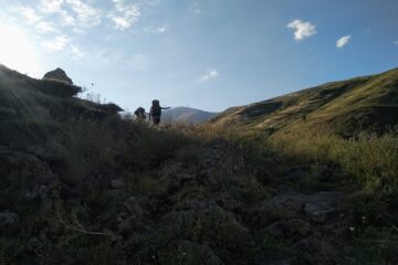
At the end of that, we enter the magnificent Artavan oak forest, which looks like it’s hanging on the steep mountain side, where giant rock cliffs pierce through the canopy towards the sky in a very original juxtaposition of rock and trees. If you say forest in Armenia, you usually mean Dilijan, Khosrov, perhaps Syunik… unfortunately very little credit is given to this little gem. I should make a point to go back there in the autumn, I bet it’s even more beautiful then.
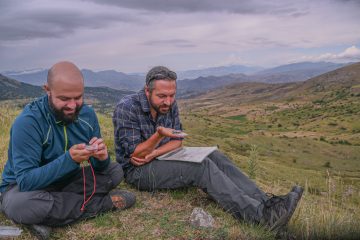
On the way out from the forest, we ended up losing the trail. But I can’t say we got lost, really. We knew we were not where we were supposed to be, but we could tell still where we needed to go. We were able to read the topography and that helped us figure out where we must have been instead, and that eventually led us through an alternative way towards the same destination. The perks of having a topo map with you, I guess. And it made it all more interesting, with a tinge of excitement, obviously.

Why did we loose the trail?
Well, maybe we missed a turn, maybe we just couldn’t see the blazes, maybe there was a little too much overgrowth… it doesn’t matter much though, what was important is that we still found our way to Artavan, and we learned a thing or two in the process:
Many organisations play an important part of this growing hiking industry in Armenia, which is young so it naturally suffers from growing pains. But it is growing! And each organisation and individuals are contributing their specialised profession to the cause; now more than ever is evident to me how much interconnected each of these parts really is.
Imperfection, enjoyable imperfection, was the theme of the day: the trail network could be certainly improved (better blazing, sometimes even better routes, some needed cleaning up due to little traffic) and I think it probably will, later on this year; same can be said for our map, as we couldn’t possibly ground proof every square meter of the land we covered, so for instance we noticed missing objects that would definitely help navigating by eye and compass (like the presence of giant boulders, or isolated trees, and other things like that), but we just couldn’t see those features on the satellite imagery we use to improve the base maps.
In the end it is worth reminding ourselves that we are opening up a new industry in Armenia, from scratch, and what matters to me is that we keep doing it all together. Because there are several pieces to this puzzle, and I don’t think we can do without any of them: we need good quality trails, both in terms of design and construction, we need good blazing and functional signposts, we also need good maps, paper and digital ones, and we need at least some decent services offered along the paths, to cater to the needs of hikers, of different styles and therefore different needs.
If we needed a reminder of the importance of cooperating and coordinating our work, we got it on a days like this. The potential is there, and to make Armenian trails truly accessible, a few adjustment in the whole process would make a big difference in the experience that hikers, just like our small group, could have.
Thankfully in a few weeks most of the trail-building community will actually share an office at the new Impact Hub Yerevan, I believe this will make it even easier to work together.
In the meantime, given that nothing is perfect, and probably nothing ever will be, the best chance one has to maximise safety and enjoyment is redundancy: you can’t rely on one single piece of infrastructure, nor technology, nor equipment, nor even knowledge. Everything is prone to fail you at some point. So it’s more about understanding the options one has, their limitations, and equip oneself with as many tools one can use.
Coincidentally, you’ll also get a deeper appreciation for all the different work that we are all collectively doing, out there, and on the maps, which -for me- was always very important: I won’t ever again take a bridge, a switchback, a draining canal, for granted on a trail I don’t think…

So, the trails are not perfect, nor is the map, nor are the apps. But they are already quite good, and as long as we keep working together to literally break new ground, I believe the hiking experience in Armenia will only keep improving, for everyone.
0 Comments