During the last week, while hiking through the Vayots Dzor mountains, I very quickly realised two things: first, I am possibly getting too old to want to do any live posts while out and about, and second, Instagram is a mystery to me anyway. Possibly for the same reason.
So instead of trying, I left the professionals keep you entertained (for a recap, just check the highlighted stories from Tom – TCT, Tsovinar – TFC and Roffi, they are so much fun!) while I’ve decided to simply collect some thoughts at the end of each day and publish them in these last few days of the month, until the promotion of our new map will end on July 31st. I hope you’ll enjoy them too.

First of all, why was this area f Vayots Dzor chosen for our second map?
The area was initially identified by the Transcaucasian Expedition back in 2016, for a somewhat unusual reason: it seemed like nobody would ever go hiking in this particular area of the central Armenia province of Vayots Dzor. Intrigued by that, Tom Allen, leader of said expedition, decided we should go and check it out, to see if there was a possible worthy route to connect to southern Armenia through those volcanic valleys. We ended up spending many weeks up there trying to find old trails, “unintentionally” climbing over massive rocky cliffs, and generally wondering around a landscape that didn’t seem to get any attention, for all the wrong reasons. Luckily things were about to change.

When TCT was finally set to route the trail through these mountains, HIKEArmenia made the wise decision of supporting and leading the creation of a whole new trail network around the long distance route, so that people could stay more days in the region. Fast forward to 2019, several new and old trails were now connecting the villages of Gomk, Martiros, and Artavan, which meant that after the Dilijan National Park, in the north, this was to be the second hiking hub with a decent amount of hiking trails for you to explore in Armenia. As part of this development project, HIKEArmenia also sponsored the production of our second map, the one that we have been presenting you this past week, that cover such brand new trail system and adding the last component to a complete hiking destination.

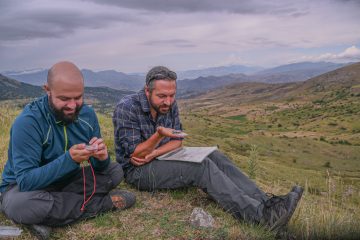
Having being there at the very beginning of the process, many thoughts were rushing through my mind while walking on those paths four years after my first journey. The truth is, it is quite indescribable what it felt and meant to be there now, seeing how it all came together. A lot of manual labour was necessary for Cartisan to bring the map data up to scratch, and a lot of sweat has been poured by Trails For Change to actually build or renovate trails on the ground, so finally having the chance to walk across this landscape again, ages after our early explorations, was kind of surreal and so very satisfying.
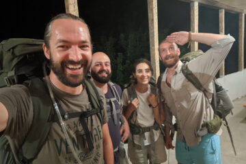
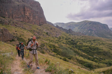
Despite the heat and heavy packs, the first day was a really fun, and a long awaited one as well. All on a brand new trail connecting Gomk to the Rock-Hewn Martirosants church above Martiros. It was the hottest day of the year (so far?) but it wasn’t so bad because we were hiking around 2000m, in a gentle breeze, with plenty of water, and this company.

***
The #HikeVayotsDzor expedition is over, but if you want your copy of the map of this new trail network, it is still on sale till the end of this month, just head to our shop at cartisan.org
0 Comments