Thanks to you all, we made, we are funded!
We’re relieved and grateful in equal measure to know this project will happen! But in anticipation of a further 72 hours of fundraising, we believe it’s important to be fully transparent about what we’ll do with any extra funds raised above the $12,900 target. With that in mind, we’ve set the following stretch goals in increasing order of ambitiousness:
If we reach 110%, we will use the surplus funds to complete the digital mapping of the entire Transcaucasian Trail route through Armenia. Over the last two years, all of the route has been scouted and field-mapped by volunteers. Reaching 110% will allow Cartisan to dedicate resources to processing their GPS data and finalising Armenia’s very first border-to-border thru-hike!
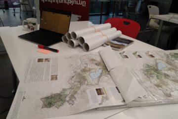
If we reach 130%, we will develop a digital equivalent of the printed topographical map, which uses the same terrain detail and feature data to display the map in digital form. It will not replace the paper map, of course, but serve to complement it, giving users of the TCT website the ability to plan their hikes in advance online.
If we reach 150% (dream big, right?), then in addition to the above, we will be able to take the second 1:25,000-scale printed hiking map in the series all the way through to the final design stage, after which only the costs of manufacture will remain (which we expect to cover using the revenue raised through sales of the first map). We’re not at liberty to disclose the area it will cover, but we’re confident that it represents the second most hiker-ready region of Armenia crossed by the TCT.
Thanks again to all who have contributed to this campaign’s success so far – now let’s see how much further we can extend our impact!

0 Comments